WRF and numerical modelling
One of our most important and promising projects for regional forecast intelligence.
Q1 2026
Request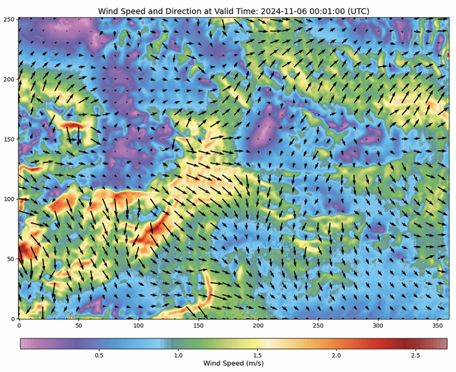
We have developed a solution to create high-resolution regional weather forecasts using GPU acceleration and, where available, supercomputer infrastructure for your region.
Our modelling setup supports spatial resolution down to the kilometer scale (or even below 1 km), with temporal resolution up to 1 minute where input data and compute resources allow.
By combining LiDAR data, high-resolution terrain and land-use data, data assimilation, and our IoT sensor network, we can significantly improve local weather forecasts.
Contact us if you need this forecast capability for your region in sectors where weather has direct operational impact, including energy, agriculture, logistics and transport, insurance, civil protection and emergency management, aviation, maritime operations, construction, and public infrastructure.
Custom studies, consulting, and data-as-a-service are in scope for partners who need tailored domains, variables, update cycles, or output formats.